Goirle climate workshop
The climate workshop was intended to gain insight into the effects of climate change on the living environment in the municipality of Goirle, and the interconnectivity of the various climate issues, the water system, and spatial planning. The workshop involved a “stress test light”: insight into the tasking with which the parties are faced, and recommendations regarding subsequent steps, based on knowledge and information currently available. In essence, the climate workshops focus on the four themes set out in the climate impact atlas: flood risk management, pluvial flooding, drought, and heat. Flood risk management is not an issue for the municipality of Goirle, which is why it has been left out of consideration.
Process
The climate workshop was structured as follows:
- During an intake meeting, the participants have exchanged their views regarding the purpose and scope of the workshop. In addition, they have drawn up a draft schedule and a list of individuals and organisations to be invited. They have also set down agreements regarding the exchange of information.
- The actual climate workshop was held on 7 June 2016.
- The workshop was evaluated on 5 July.
In preparation for the climate workshop, basic maps have been drafted for the three relevant climate issues, indicating the climate effects to be expected (see Appendix B to the downloadable document). These maps have been discussed during the workshop. The information contained in the maps has been assessed for completeness and relevance to the municipality. The discussions on the basic maps have been summarised into a vulnerabilities map, indicating the locations at which the municipality of Goirle is vulnerable to climate change, and the issues that may come into play.
Results
The climate workshop has generated the vulnerabilities map below. 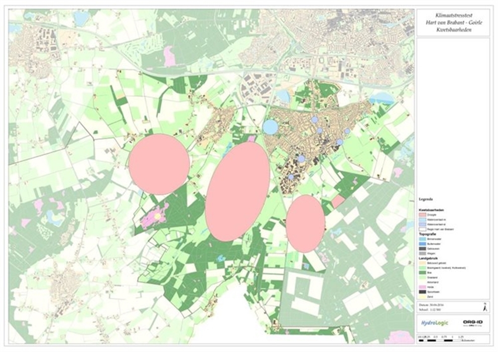
During the climate workshop, we discussed the climate issues. The main comments and vulnerabilities are:
Knowledge issues and development
- What is the effect of water extraction in the outskirts? A study into this issue is currently under way.
- What options are there to discharge water from the built-up area to the dried-up outskirts?
Climate impact
Heat
- The Goirle urban area comprises many paved gardens.
- Several locations on the map have been marked with greenery in the urban area, but there are no trees at these locations.
- The “Regte heide” area has been marked on the map as a location affected by a substantial fall in groundwater level. This location requires additional attention in terms of wetting.
- The map identifies several locations prone to (pluvial) flooding.
- The eastern section of the municipality of Goirle is farmland. It is imperative that the groundwater level be maintained in this area.
Drought
- Drought is already causing problems in the wet pearl of Nature. The drought in this area is expected to grow more extreme.
- Drying up watercourses currently do not pose a problem.
- Several locations have been marked with blue-green algae.
More details on the conclusions and recommendations are provided in the document pertaining to this practical example.
Contact person
Albert Elshof
ORG-ID
06 53 66 18 69
elshof@org-id.org